Feasibility Studies
New York
These studies explore the early-stage definition of development potential across a range of urban sites—focusing on zoning analysis, massing strategies, and spatial organization as interconnected systems.
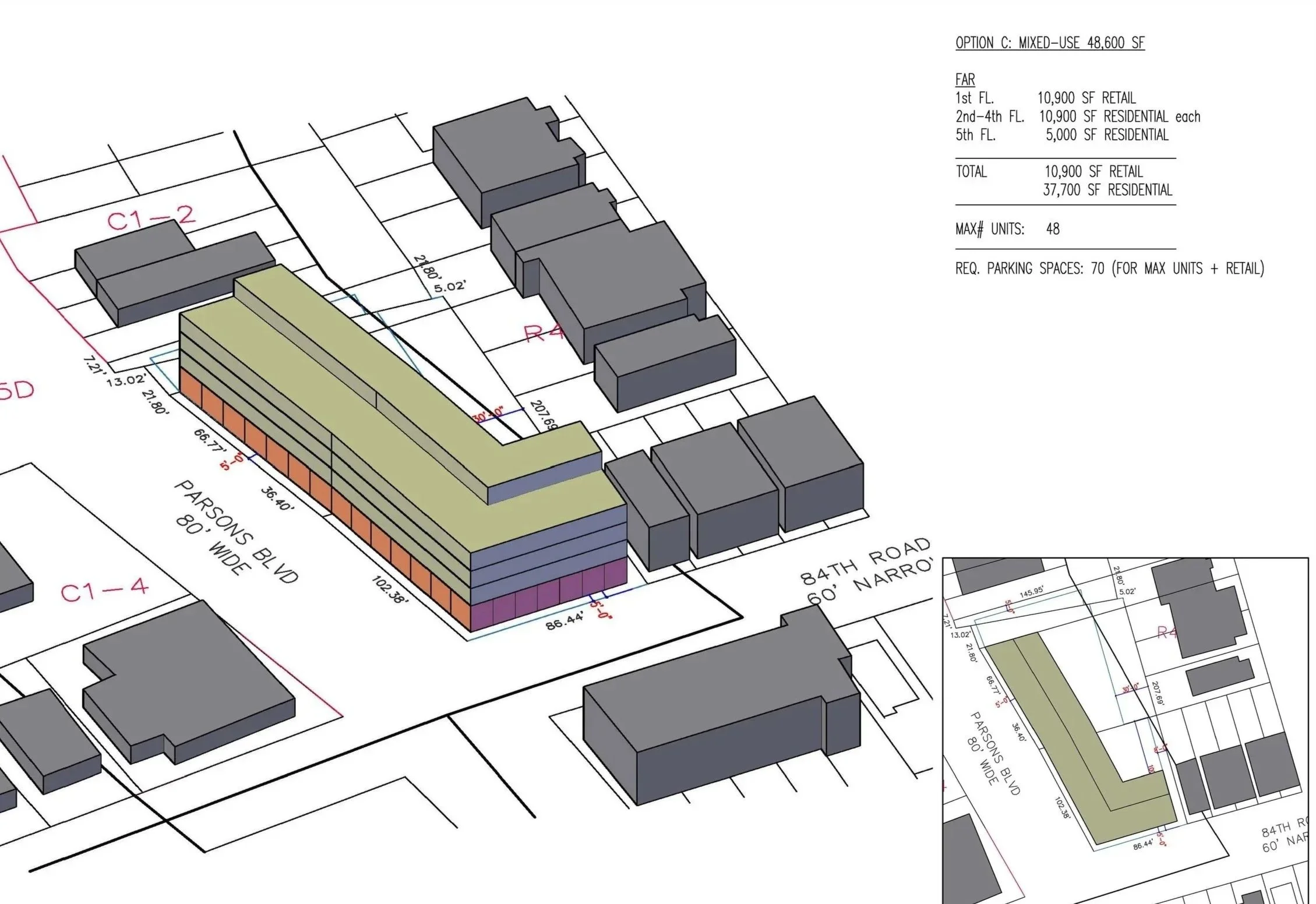
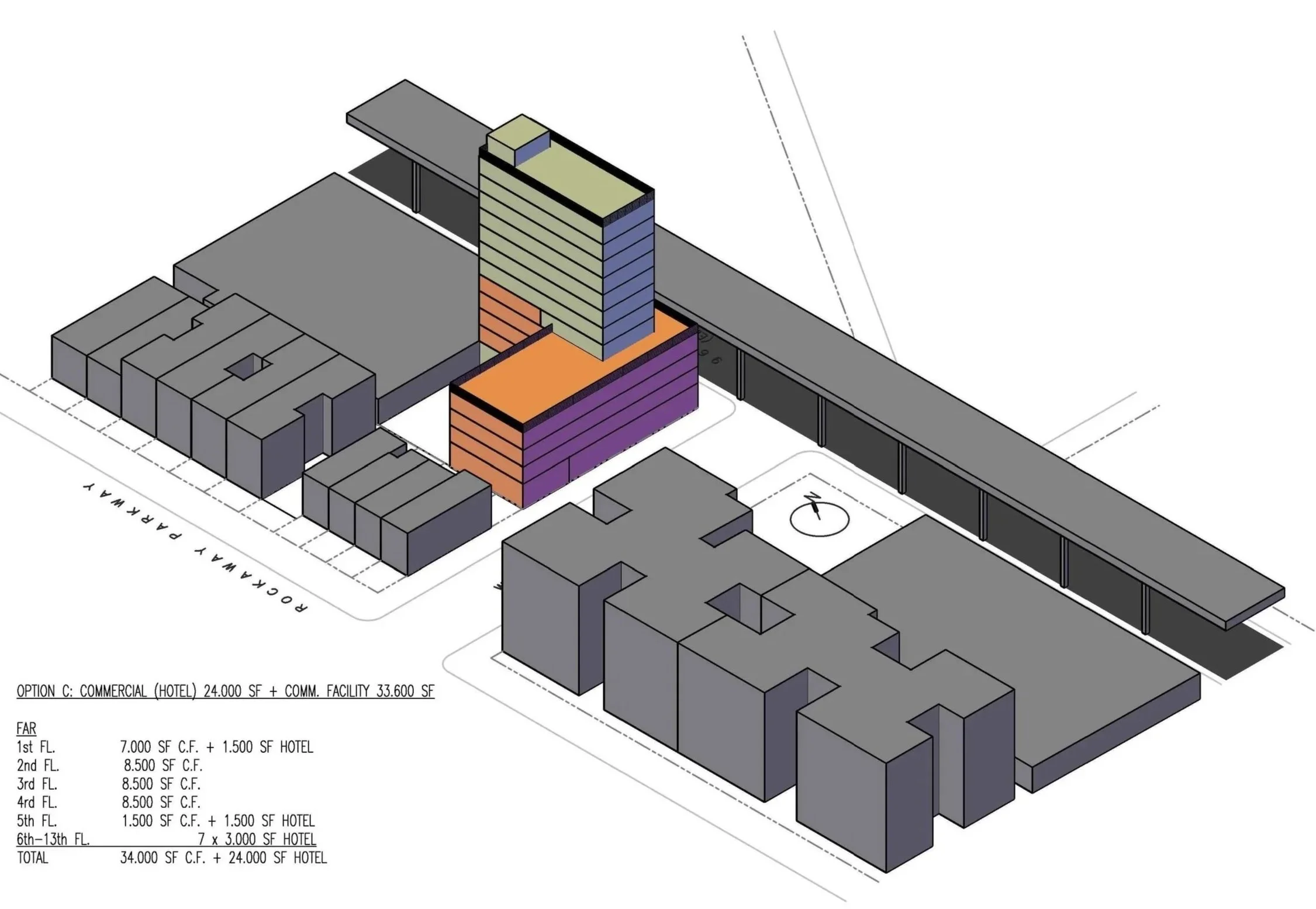
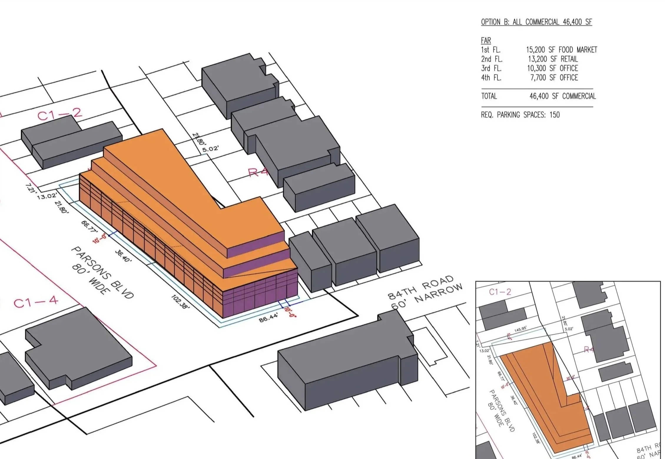
Working within the constraints of local regulations, each study tests multiple volumetric scenarios to understand how different interpretations of zoning envelopes translate into built form. Rather than treating zoning as a limitation, it is used as a generative framework—informing building scale, configuration, and relationship to context.
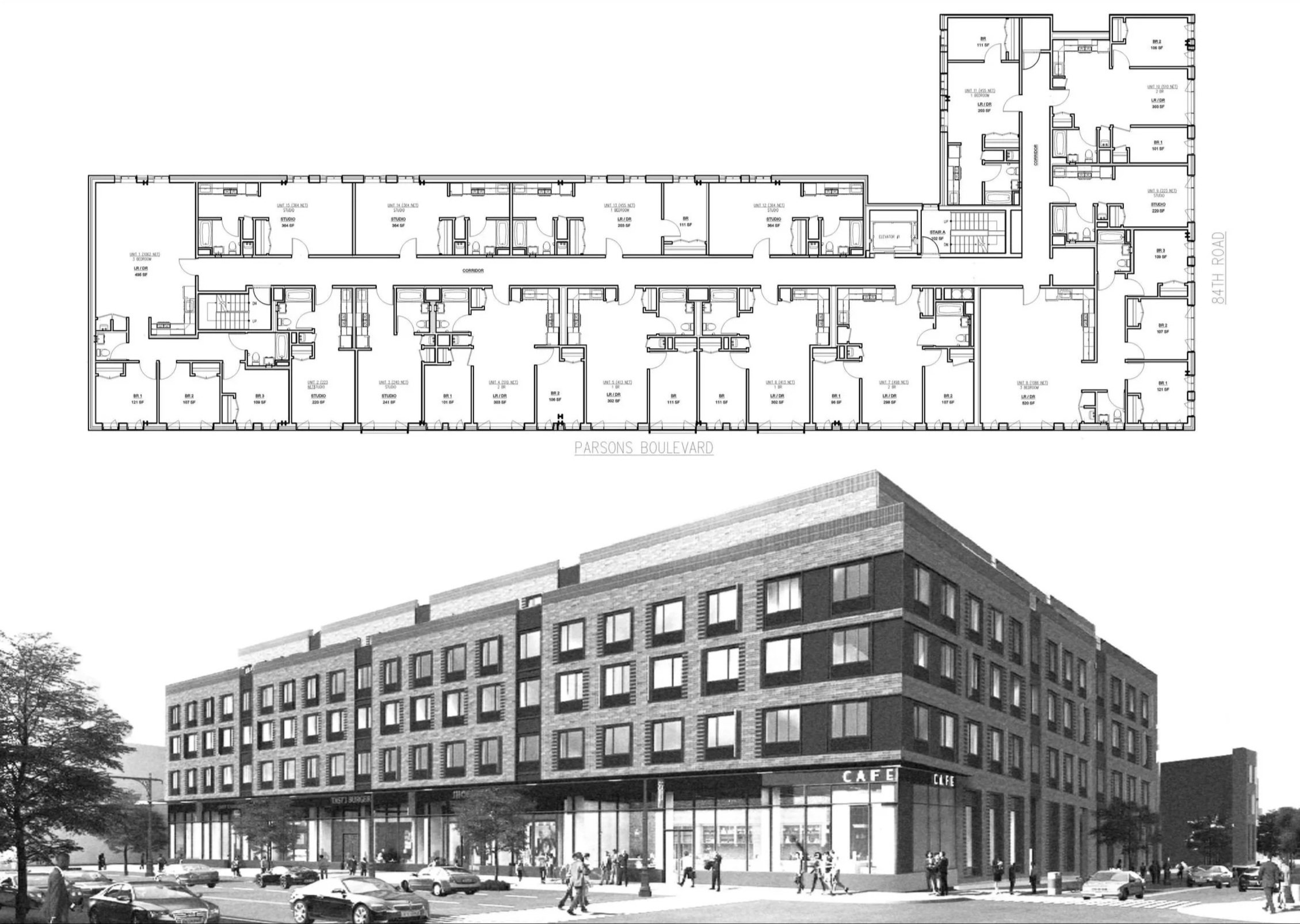
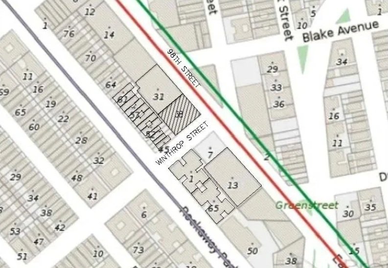
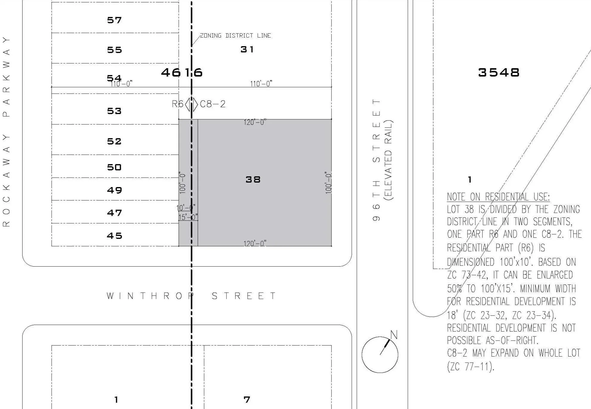
The process combines analytical rigor with spatial thinking. Site diagrams, zoning calculations, and regulatory parameters are translated into three-dimensional massing options, allowing for direct comparison between density, efficiency, and architectural quality.
METHODOLOGY
Each study typically includes:
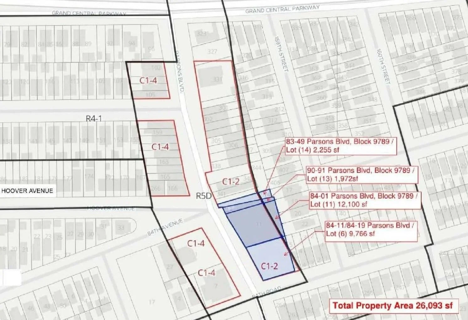
Zoning analysis and code interpretation
Buildable area calculations
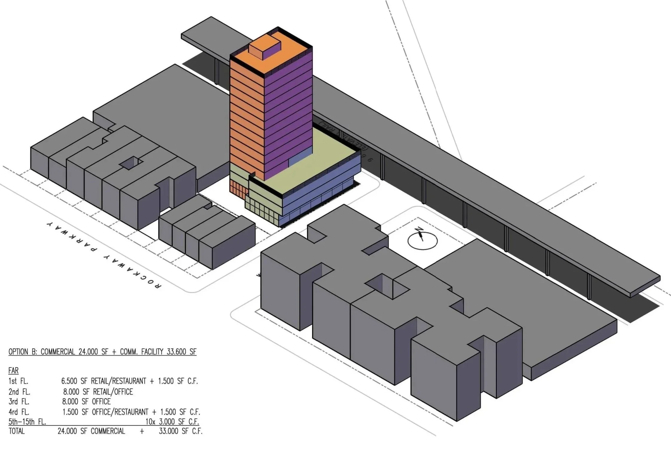
Massing iterations and volumetric testing
Preliminary unit layouts and efficiency studies
Comparative scenarios to evaluate development potential
As seen in the studies, multiple configurations are tested—from lower, distributed volumes to more vertical, compact schemes—each with distinct implications for yield, light, and urban presence.
STRATEGIC VALUE
These exercises operate as decision-making tools, allowing stakeholders to:
Understand the full development potential of a site
Compare alternative approaches before design commitment
Align architectural intent with financial and regulatory realities
Reduce risk through early clarity
Feasibility is not a preliminary step—it is where the project is defined.
156 East 98 Street, Brooklyn
8405 Parsons Avenue, Queens